One hundred forty-eighth in an alphabetical series on West Kootenay/Boundary place names
The Slocan Valley community of Perry Siding — also known as Perry’s Siding, Perry’s, and Perrys — was likely named for Charles Edward Perry (1843-1906), a civil engineer and land surveyor who worked on the Slocan branch of the Columbia and Kootenay Railway. Perry Ridge and Perry Creek were presumably also named after him.
Perry began his career in the city engineer’s office in Ottawa, then went to work on the Intercolonial Railway. He served in the Montreal Squadron of Cavalry during the second Fenian Raid of 1870 and shortly afterward came to BC. He joined the preliminary survey for the CPR mainline and worked on many other railway projects over the next 20 years.
In 1892, Perry formed a land surveying firm in Nelson with John Hamilton Gray and Montagu S. Davys and soon produced Perry’s Mining Map, a stunning piece of artwork that detailed West Kootenay’s geography and mining camps.
He also surveyed Trout Lake City, Bonanza City, New Denver, and Cody, among other local townsites. In 1896-97 the CPR hired him to work on its railway to Slocan City, followed by the BC Southern Railway.
He spent some time in the Omineca district as superintendent of the St. Anthony Exploration Co., a hydraulic mining firm, before heading back east in 1904 to join the survey of the National Transcontinental Railway between Winnipeg and Quebec.
While working in Northern Ontario, he became ill and died on March 15, 1906. Several prominent railway engineers served as pallbearers at his well-attended funeral, included Sir Sandford Fleming.
Perry Siding was originally known as Dearin Siding after Joseph Dearin (1856-1930), who was listed in the 1898 BC directory as a rancher at Lemon Creek. The name first appeared in the Nelson Tribune of Jan. 9, 1900, which recorded Dearin staying at the Sherbrooke Hotel. The final reference, in the Slocan Drill of March 24, 1906 noted the birth of Dearin’s daughter.
This spot was also identified as Proctor Siding on W.A. Brock’s geological survey sheet of West Kootenay in 1900, but this might have been just a mistake, caused by confusion with Procter on Kootenay Lake. James White’s Altitudes in the Dominion of Canada (1901) also lists Proctor Siding as a spot a few miles south of Lemon Creek, but may have relied on Brock’s work.
Brock’s map was also the first to label Perry Ridge, a name adopted by the Geographic Board of Canada on June 30, 1904, which was careful to identify it as “Perry Ridge (not Perry’s Ridge).”
When Charles Perry died, the CPR paid tribute to him by adding Perry Siding to its timetable on May 6, 1906. The Perry Siding post office opened on March 1, 1907 and closed in 1949.
Officialdom had a hard time figuring out what to do with the name. Perry Siding was originally adopted in the 1909 BC Gazetteer as the name of a post office and flag station. In 1956, it was reclassified as a settlement, and in 1986 the name changed to Perrys, a community.
Separately, Perrys was adopted as the name of the railway station in 1955, as identified on CPR timetables. The name was rescinded in 1973 but reinstated in 1976.
Doukhobor settlers called the area Persekovoe (or Periskovoye), Russian for “land of peaches.” But was the name meant to sound like Perry?
According to Jon Kalmakoff of the Doukhobor Genealogy Website, “Persikovoye does indeed translate as ‘place of peaches’ or ‘land of peaches.’ From a Russian grammatical perspective, Persikivoye cannot be a Russianization of Perry. To be so, it would have to be Perivoye, or something similar. That said, the original Doukhobor namers may have chosen it because of its similarity to Perrys.”
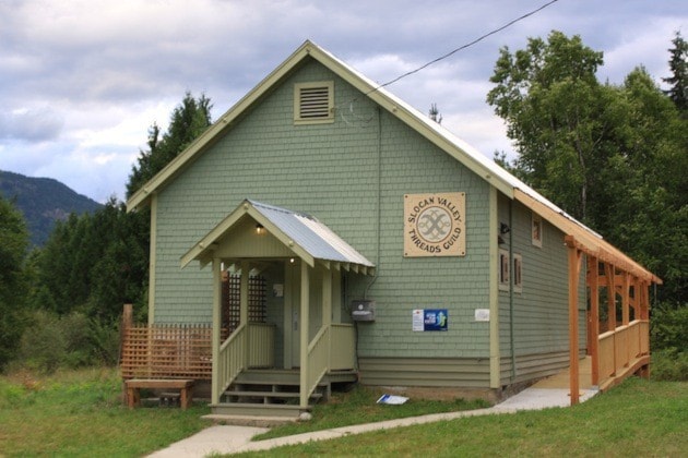
The name survives in Perrys Back Rd.
Previous installments in this series
Applegrove, Appleby, and Appledale revisited
Bakers, Birds, and Bosun Landing
Bannock City, Basin City, and Bear Lake City
Bealby Point (aka Florence Park) revisited
Boswell, Bosworth, Boulder Mill, and Broadwater
Brooklyn, Brouse, and Burnt Flat
Camborne, Cariboo City, and Carrolls Landing
Carmi, Cedar Point, Circle City, and Clark’s Camp
Carson, Carstens, and Cascade City
Christina City and Christian Valley
Cody and Champion Creek revisited
Champion Creek revisited, again
Columbia City, Columbia Gardens, and Columbia Park
Crawford Bay and Comaplix revisited
Dawson, Deadwood, and Deanshaven
English Cove and English Point
Forslund, Fosthall, and Fairview
Fort Shepherd vs. Fort Sheppard, Part 1
Fort Shepherd vs. Fort Sheppard, Part 2
Gladstone and Gerrard, revisited
Hall Siding and Healy’s Landing
Hudu Valley, Huntingtdon, and Healy’s Landing revisited
Inonoaklin Valley (aka Fire Valley)
Jersey, Johnsons Landing, and Jubilee Point
Kootenay Bay, Kraft, and Krestova
Kuskonook (and Kuskanax), Part 3
Labarthe, Lafferty, and Longbeach
Makinsons Landing and Marblehead
McDonalds Landing, McGuigan, and Meadow Creek
Meadows, Melville, and Miles’ Ferry
Mirror Lake and Molly Gibson Landing
Montgomery and Monte Carlo, Part 1