Fortieth in a series on West Kootenay/Boundary place names
Corra Linn is one of three falls on the Kootenay River between Nelson and South Slocan, named along with Bonnington and Stonebyres by Sir Charles Ross after counterparts on the River Clyde in Scotland.
According to the BC Geographic Names website, the name may come from the Gaelic “corrach linne” meaning “angry cataracts” or “precipitous water.”
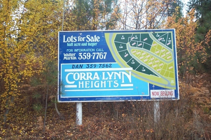
Corra Linn is also the name of the dam on the falls and the area around it. But it’s frequently misspelled Corra Lynn — in fact, that’s how it’s appeared in the earliest known reference in the Nelson Daily News of June 22, 1906.
It was also misspelled in the phone book, on the road sign, and on the “Corra Lynn Heights” subdivision sign. This annoyed the late Dave Macdonald, who lived there, and inspired Bob Hendrie to compose an Epistle to W.D. Macdonald at Corra Linn:
 The highway sign on the road you live
If it be correct spelled
Would suggest it is named after someone’s wife
I’ve heard the claim upheld
But you and I know different Dave
When from Scotland of renown
A lad named Ross who noticed falls
Like the River Clyde flowed down
He named them Corra Linn he did
With an I and not a Y
Why then did you let the D of H [Department of Highways]
Away with it Davy, why?
Have they put a clamper oan yer tongue
Or chained up baith yer hauns
Rise up an gie them a blastin’ man
And behind you will be the clans
And when I pass your way again
I’ll look with satisfaction
For an I instead of a Y in Linn
Put there by a man of action
Macdonald successfully got the road sign changed.
Cooper Creek
This community is named for a stream that flows into the Duncan River just above the north end of Kootenay Lake.
Its namesake is uncertain, but it was first mentioned in the Nelson Miner of September 5, 1891: “[I]t was found that a big fire had run through the country, damaging the trail for a distance of four miles and burning out the bridge across Cooper creek.”
It also appears on Perry’s Mining Map of West Kootenay, published in 1893, while another map gives it as “Cooper or Stony Creek.”
In a 1949 letter to A.G. Harvey, held by the BC Provincial Archives, Margaret Garland said it was after “a farmer who came to these parts ... The Cooper family took up land and later moved away. It has carried the name ever since.” (They must have departed by 1901, for no Coopers are in the area on the census that year.)
Elsewhere Harvey stated Cooper was “a Kaslo trapper and prospector in the 1880s.”
In the 1920s, a Mr. Cooper set up a sawmill at Cooper Creek, but according to Ernie Alexander in Lardeau Duncan Memories, the name was coincidental.
Previous installments in this series
Applegrove, Appleby, and Appledale revisited
Bakers, Birds, and Bosun Landing
Bannock City, Basin City, and Bear Lake City
Boswell, Bosworth, Boulder Mill, and Broadwater
Brooklyn, Brouse, and Burnt Flat
Camborne, Cariboo City, and Carrolls Landing
Carmi, Cedar Point, Circle City, and Clark’s Camp
Carson, Carstens, and Cascade City
Christina City and Christian Valley
Cody and Champion Creek revisited