Seventy-eighth in an alphabetical series on West Kootenay/Boundary place names
Gray Creek, on the East Shore of Kootenay Lake, is one of the more puzzling local place names, with several theories about its origin.
Here’s what we know: Perry’s Mining Map of 1893 labelled the settlement Grays. The spot also shows up as Ironton on an early preemption map, presumably after iron deposits in the area, although that name didn’t gain much traction.
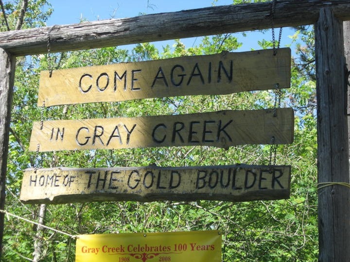
For many years, the community was known interchangeably as Grays Creek, Gray’s Creek, Gray Creek, and (probably erroneously) Grey’s Creek. Grays Creek was officially adopted in 1903, based on an 1898 CPR map, and was not changed to Gray Creek until 1947. However, the post office opened in 1908 as Gray Creek.
The first newspaper mention of Gray’s Creek is in The Ledge of June 3, 1897: “Some very rich strikes are reported on Crawford creek. Samples of large cube galena were brought in last week … from a find lately made on the divide between Gray’s Creek and Le France [sic] creek, supposed to be a continuation of the great Gordon Dyke discovered by Jack Redding in July ’95 …”
Another early mention appeared in the Nelson Tribune on March 3, 1899: “John P. Redding of Kaslo has transferred … an undivided one-eighth interest in each of the mineral claims Gold Reef, about two miles from Crawford Bay on Gray’s creek, and the Gordon, about five miles from the same bay.”
Redding’s name in these examples is significant, as we’ll later see.
The first use of Gray Creek without the apostrophe is from the Tribune of September 23, 1899, in a legal ad for timber rights taken out by Harry Houston: “Commencing at a post about two and a half miles up from the mouth of a creek running into Crawford Bay on Kootenay lake, and known as Gray creek …”
The creek itself first appeared on J.W. Trutch’s 1871 map of BC, but without a name.
On Perry’s 1893 map, it’s called Baker Creek, a name subsequently given to another stream east of the Gray Creek Pass. According to an unpublished history of the area by Kathleen Lymbery, an 1895 map called it Louise Creek, although it’s not clear which map she was referring to.
Croasdaile Creek, named for landowner/developer Henry Croasdaile (1846-1915), is said to have been known as Gray Creek before the name was given to the much larger neighbouring stream.
Frances Roback of the Gray Creek Historical Society notes: “Gray Creek appears named on maps while other creeks here often weren’t. Gray Creek often was the only named creek between Crawford Creek and LaFrance Creek. It’s reasonable to suppose that as Gray Creek was a major part of the East-West Kootenay route across the divide historically, mapmakers would be more likely to name the creek.”
So who was it named after?
Folklore suggests an old prospector named Grey, who was related to novelist Zane Grey.
Another guess is civil engineer and land surveyor John Hamilton Gray (1853-1941), whose father was among the Fathers of Confederation. By March 1892, Gray was in partnership with Montagu Davys and Charles E. Perry (who created the above-mentioned map) in a surveying, real estate, and mine brokerage business with offices in Victoria and Nelson.
Gray was later chief engineer of the Kaslo and Slocan Railway. In early 1898, he and the railway’s president visited the future site of Kuskonook and decided to survey a townsite. Nothing, however, ties him specifically to Gray Creek.
There is another, stronger candidate for the namesake: Aulden S. Gray. More on him next week.
— Thanks to Frances Roback and Tom and Sharon Lymbery
Previous installments in this series
Applegrove, Appleby, and Appledale revisited
Bakers, Birds, and Bosun Landing
Bannock City, Basin City, and Bear Lake City
Bealby Point (aka Florence Park) revisited
Boswell, Bosworth, Boulder Mill, and Broadwater
Brooklyn, Brouse, and Burnt Flat
Camborne, Cariboo City, and Carrolls Landing
Carmi, Cedar Point, Circle City, and Clark’s Camp
Carson, Carstens, and Cascade City
Christina City and Christian Valley
Cody and Champion Creek revisited
Champion Creek revisited, again
Columbia City, Columbia Gardens, and Columbia Park
Crawford Bay and Comaplix revisited
Dawson, Deadwood, and Deanshaven
English Cove and English Point
Forslund, Fosthall, and Fairview
Fort Shepherd vs. Fort Sheppard, Part 1
Fort Shepherd vs. Fort Sheppard, Part 2