One-hundred fifty-third in an alphabetical series on West Kootenay/Boundary place names
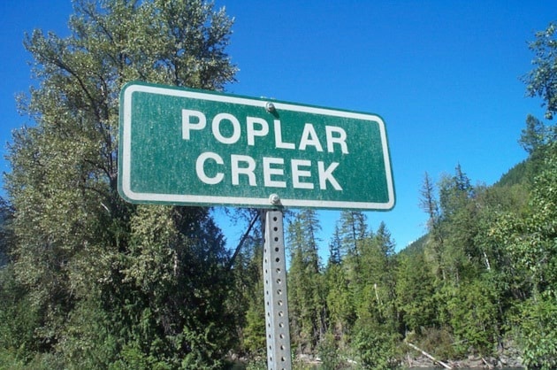
The Lardeau ghost town of Poplar Creek, also known as Poplar City and just Poplar, was the site of a short-lived gold rush that began in 1903.
The creek itself was first mentioned in the BC government sessional papers of 1892 and appears on Perry’s Mining Map of 1893, but it didn’t receive much attention at first.
When James White of the Canadian Geographic Survey inquired about the name in 1905, postmaster A.G. Johnston replied: “Poplar Creek named after the creek of the same name. The town is situated at the junction of Poplar Creek with the Lardeau River. Both sides of the creek are lined with ‘Balm of Gilead’ trees mistaken by early prospectors for poplar, hence the name.”
The Poplar townsite was surveyed by A.R. Heyland on Aug. 28, 1903. Its streets were named Poplar, Front, and Marquise. (The latter is a noblewoman’s rank and also a place in France.)
 In 1914, the Geographic Board of Canada was trying to do away with name duplications and apparently considered renaming Poplar Creek when it received a letter from William F. Robertson: “This creek and name defines the boundary line between the Trout Lake and Ainsworth mining divisions, so has an officially documentary stand and we must continue to use it. The town of that name was a mining recording office and was the place where the provincial mineralogist [i.e. Robertson himself] was ‘burned in effigy’ for an unfavorable report on the camp (the camp has since died a natural death). So you can see the camp has tender associations which I hope the board will respect.” They did, and Poplar Creek it remains.
The Poplar Creek post office opened on Nov. 1, 1903 and closed May 31, 1954 — 50 years after the town’s heyday.
By 1905, a siding at or near Poplar on the Arrowhead and Kootenay Railway was called McInnes, or MacInnes. According to Roger Burrows in Railway Mileposts, Vol. II, it was “believed named for George McInnes, a sawmill owner at Howser.” John George McInnes (1891-1959) was indeed a lumberman in the Kootenays but he was only 14 in 1905.
Eight people named McInnes appear on the 1901 census living in West Kootenay, but none seems an obvious namesake. The pages of the recently digitized Poplar Nugget, a newspaper that operated from December 1903 to November 1904, don’t mention anyone by that name.
However, possible namesakes include Angus McInnes, recorder of the Slocan Mining Division, and Thomas Robert McInnes (1840-1904), BC’s sixth lieutenant governor, who signed the act to incorporate the Arrowhead and Kootenay Railway.
Below: A ca. 1905 postcard image of Poplar Creek.
Porcupine
The only mention of this obscure place was in the Kaslo Kootenaian of June 15, 1899. Charles Moore wrote: “About nine miles up [Woodbury Creek] is the townsite of Porcupine; the structure to mark its identity is a fine two-story log cabin, owned by Messrs. Johnson & Co.”
Porcupine Siding
According to Jon Kalmakoff’s Doukhobor Gazetteer, this siding on the Great Northern Railway was built in 1902 at the confluence of Porcupine Creek and Salmo River, one mile south of Ymir.
Railcars were loaded there with ore from the Hunter V mine from 1902-05 and lumber from local sawmills from 1906 onward. Community Doukhobors also bought timber limits there in 1918 and established a camp, which was destroyed in a 1924 forest fire.
A late reference appeared in the Victoria Daily Colonist of Aug. 5, 1928: “The Howard group of claims is situated on the eastern slope of the south fork of Porcupine Creek, the compressor plant being located at the foot of the hill, about six miles from Porcupine siding on the Great Northern Railway.”
The siding was abandoned in the 1930s.
The creek itself was first mentioned in the Nelson Miner of Feb. 6, 1897 among a list of mining claims.
Previous installments in this series
Applegrove, Appleby, and Appledale revisited
Bakers, Birds, and Bosun Landing
Bannock City, Basin City, and Bear Lake City
Bealby Point (aka Florence Park) revisited
Boswell, Bosworth, Boulder Mill, and Broadwater
Brooklyn, Brouse, and Burnt Flat
Camborne, Cariboo City, and Carrolls Landing
Carmi, Cedar Point, Circle City, and Clark’s Camp
Carson, Carstens, and Cascade City
Christina City and Christian Valley
Cody and Champion Creek revisited
Champion Creek revisited, again
Columbia City, Columbia Gardens, and Columbia Park
Crawford Bay and Comaplix revisited
Dawson, Deadwood, and Deanshaven
English Cove and English Point
Forslund, Fosthall, and Fairview
Fort Shepherd vs. Fort Sheppard, Part 1
Fort Shepherd vs. Fort Sheppard, Part 2
Gladstone and Gerrard, revisited
Hall Siding and Healy’s Landing
Hudu Valley, Huntingtdon, and Healy’s Landing revisited
Inonoaklin Valley (aka Fire Valley)
Jersey, Johnsons Landing, and Jubilee Point
Kootenay Bay, Kraft, and Krestova
Kuskonook (and Kuskanax), Part 3
Labarthe, Lafferty, and Longbeach
Makinsons Landing and Marblehead
McDonalds Landing, McGuigan, and Meadow Creek
Meadows, Melville, and Miles’ Ferry
Mirror Lake and Molly Gibson Landing
Montgomery and Monte Carlo, Part 1