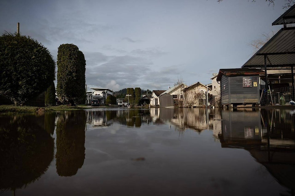
The emergency program coordinator in northwestern British Columbia says 15 to 20 structures are heavily flooded in three communities where an evacuation order has been issued.
Rich Boehm of the Regional District of Kitimat-Stikine says residents of the communities of Old Remo, New Remo and Usk were ordered out of their homes Sunday evening and told to register at a community centre just east of Terrace.
He says roads are flooded in the Old Remo area, as are some lower sections of New Remo, but a break in the weather has slowed the rise of the Skeena River.
Boehm, who is also the fire chief for the district, says the river must recede far enough before an estimated 300 people can return home.
For now, he says some residents are staying with family while others have been put up in hotels or are living in their recreational vehicles in a nearby field while they are provided with necessities.
Boehm says higher-than-normal temperatures led to melting snowpacks, creating floodwaters that entered homes in the low-basin area.
“They are impacted just about every year,” Boehm said of those who had to escape before they became isolated. “Some years are better, this one being a little bit worse than normal.”
The Regional District of Kitimat-Stikine also declared a local state of emergency as a flood watch remains in place for the Skeena and Bulkley rivers from Telkwa and Smithers to Terrace.
Flood watches were posted Sunday for the Dean River in the Fraser Plateau east of Bella Coola and for the Liard River and its tributaries around the northeastern B.C. community of Fort Nelson and along Highway 97 toward Watson Lake.
High streamflow advisories cover many other streams and rivers in the northwest corner of the province.
The River Forecast Centre says the flood danger is dropping for much of the southern Interior, from the Cariboo Plateau to the U.S. border.
—The Canadian Press
RELATED: Evacuations, local state of emergency in northwest B.C., as flood risk rises