by John Boivin
Local Journalism Initiative Reporter, Valley Voice
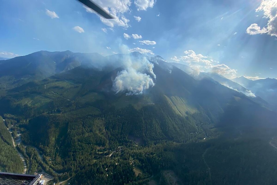
A fire that put on an unsettling display for residents of Kaslo this summer shouldn’t cause any major problems with water quality or debris flow hazards in the long term, says a report from the forestry ministry.
The Briggs Creek fire, which began Aug. 1 in the high country about 11 kilometres west of Kaslo, was clearly visible at night, and at its height occasionally dropped ash on the community. Residents of the Kaslo South Fork Road area were put on evacuation alert for several weeks.
Now a report from the Ministry of Forests has detailed just how bad the fire was, and if it has increased hazards in the long term. Forest fires can undermine soil integrity, change water flow patterns and increase the chance of floods, mudslides and other debris flows in burned-out areas and downstream.
The report by provincial geomorphologist Sarah Crookshanks breaks up the fire into three basins.
Keen Creek, the largest, saw seven per cent of its basin burn: three per cent severely and three per cent moderately. However, it’s not likely to cause problems with debris flows downstream.
“The steep tributaries that burned in the Keen Creek watershed are susceptible to debris flows and debris floods,” Crookshank writes. “However, the Keen Creek channel gradient (three-to-six per cent) is not steep enough to transport these events to the fan. A debris flow in one of these steep tributaries would most likely be diluted by the main flow in Keen Creek, and result in turbid water at the mouth of Keen Creek.”
The report notes the fire elevated the flood risk for some properties in the area and Kaslo South Fork Road, but estimated that risk hazard as low. It also says water users may see more turbidity in the spring and after big rainstorms, and may want to beef up their water filtration systems.
Only one per cent of the Kemp Creek watershed burned, and of that, just .05 per cent suffered high burn severity, while 0.5 per cent was moderately burned.
“Therefore, the likelihood of the burned area contributing to the initiation of a debris flow or flood is negligible,” says the report, noting the watershed is already susceptible to debris floods with no disturbance.
“The likelihood of water quality impacts from the burned area is also negligible,” notes the report. That’s good news for Kaslo residents, who get their water from that stream.
No recommendations were given for the smaller, unnamed watershed affected by the fire. It saw a quarter (27 per cent) of its watershed burn – three per cent severely, 12 per cent moderately.
Due to its remote location and inaccessible terrain, the BC Wildfire Service crews mostly worked to contain the Briggs Creek fire’s spread, not extinguish it. It will likely smoulder into the winter, and is currently listed as ‘being held.’
Crookshanks concludes her report saying further analysis of post-wildfire natural hazards for the fire “is not recommended.”