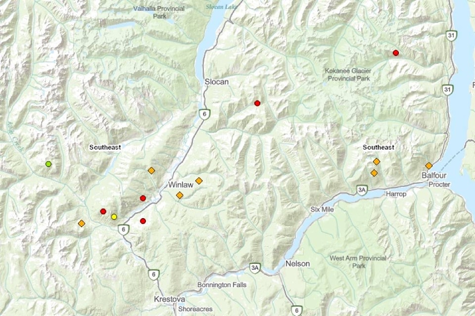
There are 17 wildfires burning in the part of the West Kootenay south of Nakusp, according to the BC Wildfire Service’s interactive map on Aug. 19 at 10 a.m. Most were started by lighting in the past two days.
On the North Shore of Kootenay Lake there are new fires at Queens Creek, Bradley Creek, and Redfish Creek, all listed as under 0.01 hectare in size.
In Kokanee Creek Park, the Woodbury Creek fire is 150 hectares in size and is being monitored but not actively fought because of difficult terrain and the remoteness of the fire.
A lightning-caused fire east of Slocan at Crusader Creek is listed as 0.8 ha in size.
In the Slocan Valley in the vicinity of Winlaw, there are fires at Fairful Creek, Trozzo Creek, Winlaw Creek and Hird Creek, all less than 0.5 ha.
South of those fires, the Watson Creek fire is at 1.2 ha, the Perry’s fire measures 0.45 ha, the Airy Creek fire is 1.06 hectare, and Renata Creek on the Arrow Lakes west of Castlegar is .2 ha. in size.
Other fires are at Caribou Creek west of New Denver (1.5 ha) and Holmes Creek west of Kaslo (0.03 ha).
There are 60 fires burning in the Southeast Fire Centre, more than any other fire area in the province. The Southeast Fire Centre extends from the U.S. border in the south to Mica Dam in the north, and from the Okanagan highlands and Monashee Mountains in the west to the B.C.-Alberta border in the east.
bill.metcalfe@nelsonstar.com
Like us on Facebook and follow us on Twitter