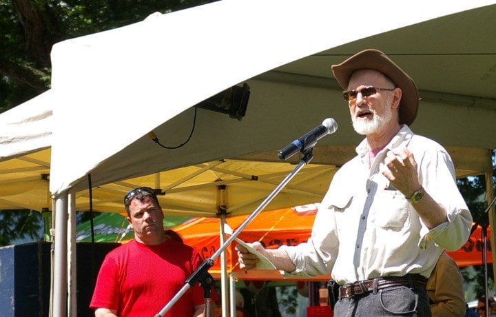
Southern Interior MP Alex Atamanenko is calling a proposal to push Nelson into the Kootenay-Columbia federal riding “bizarre.”
Last week the Federal Electoral Boundaries Commission for British Columbia proposed a new electoral map for consideration at public hearings taking place this fall. British Columbia is gaining six electoral districts as a result of the increase in its population.
In the proposed map, Nelson would be bumped to the Kootenay-Columbia riding which runs all the way to the Alberta border and north past Revelstoke. Nelson would be on the extreme west edge of the new riding which would end near the city limits and not include the entire Regional District of Central Kootenay.
“I am not looking at this from the point of view of political parties,” said Atamanenko, who represents the NDP in Canadian parliament. “I’m looking at the logistics, the accessibility, the communities of interest, the historical breakdown. What they have proposed is wrong on all counts.”
Nelson would also be in a different riding than Castlegar and Trail, but would remain in the riding with Salmo and Nakusp (see below for exact specifications as laid out in the report).
“The MP has to be accessible, there has to be some kind of flow,” said Atamanenko, who has been elected as the MP for the Southern Interior riding three times since the 2006 election. “Plucking Nelson out of the riding doesn’t make any sense. We have this infrastructure where we all work together, the MLAs and local government officials, then to have a major community taken out of this is bizarre.”
The proposal takes into account British Columbia's increase in population from 3,907,738 in 2001 to 4,400,057, as captured in the 2011 census.
The riding to the west would be known as South Okanagan-West Kootenay. It would bring Penticton in and Princeton (currently in the BC Southern Interior) would be out.
Since being elected to Parliament, the Castlegar-based Atamanenko said it has been a challenge to represent some of the communities in the western edges of the riding. The MP has a full-time office in Castlegar and a part-time office in Oliver, but his assistant only gets to visit that location once a month.
“We do the very best we can and the constituents seem to be happy,” said Atamanenko, adding that he does not visit that end of the riding as much as he works in the West Kootenay.
The three member commission is made up of the John E. Hall, chair, Stewart Ladyman and Dr. J. Peter Meekison.
In addition to looking at population numbers, the commission focused on historical patterns and community of interest or identity to achieve the goal of effective representation in Parliament.
Under the Electoral Boundaries Readjustment Act, the commission's main aim in redrawing boundaries is to divide the province into electoral districts as close to the average population as reasonably possible.
Over the years, Atamanenko said he has worked hard on a regional approach with the communities in the West Kootenay. Nelson’s departure would hinder that groundwork.
“Putting Nelson in there doesn’t make any sense for us,” he said. “We work together with Trail and Castlegar, we have this whole area that is homogenous and to all of a sudden take a pocket of this and move it into another riding simply doesn’t make sense.”
The commission will now travel the province to gather input. It will be in Nelson on October 2. Those wishing to make a presentation must submit and information the commission by August 30.
Atamanenko said he plans to voice opposition.
“I’m in the process of drafting up a position paper on this,” said Atamanenko. “I will be sharing it with local government officials and others to hopefully get folks to intervene in the process from various angles.
“We have some homework to do, this is not a done deal.”
Nelson has long been an NDP stronghold of support and the East Kootenay has traditionally sent a conservative candidate to Ottawa over the years, but Atamanenko said that is not his primary concern at this point.
“Are they stacking the deck trying to take Nelson out? I don’t even want to look at that,” he told the Star. “I want to look at how we can make this riding function the best we can regardless of who holds this position.”
If the ridings are changed as proposed for the next federal election, Atamanenko said he would be sad to not visit a community that is a steady stop for his constituency work.
“I’m so used to going there,” he said. “It would be really bizarre for me not to be able to visit Nelson on a regular basis.”
Nelson has been part of five different riding configurations since 1917. From 1917 to 1984 the riding was known as Kootenay West. Between 1988 and 1997 it was changed to Kootenay West-Revelstoke. In the 1997 election it was known as West Kootenay-Okanagan before being changed to Kootenay-Boundary-Okanagan for the 2000 election. Nelson has been part of the Southern Interior riding since 2004.
Only two MPs have been based in Nelson since 1917 — Progressive Levi William Humphrey (elected 1921) and NDP Lyle Kristiansen (elected 1980 and 1988).
For more information head to commission’s website.
Make up of the proposed Kootenay-Columbia federal riding (population 109,058)
Consisting of:
- ( a ) the Regional District of East Kootenay;
- ( b ) those parts of the Regional District of Central Kootenay comprised of:
(i) the villages of Nakusp and Salmo;
(ii) the Town of Creston;
(iii) subdivisions A, B, C, G and K;
(iv) the City of Nelson;
(v) that part of Subdivision D lying northerly of a line described as follows: commencing at the intersection of the southwesterly production of Cooper Creek with the westerly limit of Subdivision D; thence generally northeasterly along said production and said creek to the Duncan River; thence northerly along said river to Hamill Creek; thence generally northeasterly along said creek to a point at latitude 50°16'55"N and longitude 116°35'50"W; thence easterly in a straight line to the easterly limit of said subdivision;
(vi) that part of Subdivision E lying southerly of the Kootenay River;
(vii) those parts of Subdivision F comprised of:
a. that part lying southerly of a line described as follows: commencing at the intersection of the westerly limit of Subdivision F with Highway No. 3A+6; thence generally northeasterly along said highway to the southeasterly limit of said subdivision;
b. that part lying easterly and southerly of a line described as follows: commencing at the intersection of the southerly limit of Subdivision F (Kootenay River) with the southerly projection of Grohman Creek; thence generally northerly along said projection and Grohman Creek to a point at approximate latitude 49°31'03"N and longitude 117°19'59"W; thence easterly in a straight line to the northwesterlymost point on the limit of the City of Nelson;
(viii) that part of Subdivision H lying easterly and southerly of a line described as follows: commencing at the intersection of the southerly limit of said subdivision with Highway No. 3A; thence generally northerly and easterly along said highway and Highway No. 3A+6 to the easterly limit of said subdivision;
- ( c ) that part of the Columbia-Shuswap Regional District comprised of: the City of Revelstoke; the Town of Golden; subdivisions A and B; and
( d ) that part of the Regional District of Kootenay Boundary comprised of Subdivision A and the villages of Fruitvale and Montrose.