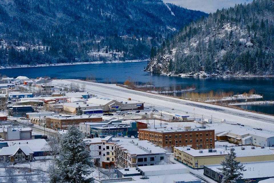
Nelson council is considering lowering the speed limit within the city from 40 to 30 kilometres per hour.
The move would be part of its implementation of the city’s Active Transportation Plan, with the goal to make the city safer for pedestrians and cyclists.
According to a report presented at council’s Feb. 9 meeting, if a vehicle travelling at 30 kilometres per hour hits a pedestrian or cyclist, the risk of death for the pedestrian or cyclist is 10 per cent. If the vehicle is travelling at 50 km/hr, the risk is 80 per cent. Traffic planners refer to 30 km/hr as “survival speed.”
This speed reduction in municipalities is recommended in the province’s 2016 report Where the Rubber Meets the Road: Reducing the Impact of Motor Vehicle Crashes on Health and Well-being in BC. Cities that have done this, according to the city staff report, include Rossland in 2015, parts of Vancouver as pilot projects, Montreal and Brussels.
The speed limit in Nelson won’t change overnight, but the exploration and planning will happen this year. City staff will have to work with the province, which administers the Motor Vehicle Act, and they plan to conduct a public consultation with Nelson residents.
The full staff report presented to council can be found here.
In addition to the speed limit change, council voted at its Feb. 9 meeting to pursue several other items in 2021 to advance the Active Transportation Plan.
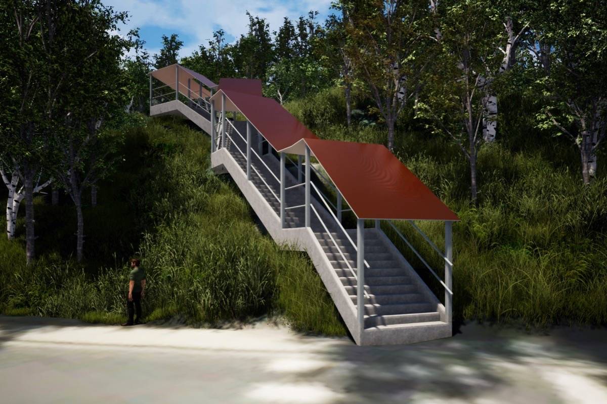
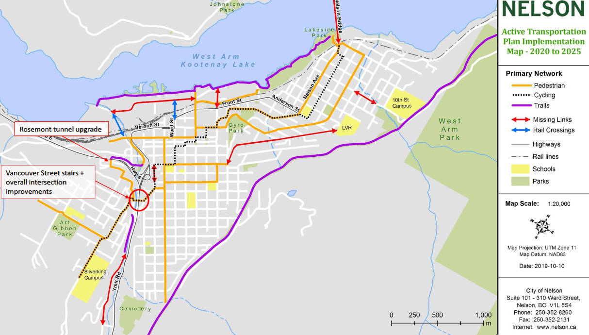
Routes to Rosemont, rail crossing, and snow clearing
Planned improvement of pedestrian and bike travel between Rosemont and other parts of the city will include a pedestrian stairway between the upper and lower parts of Vancouver Street, enhancements to the Rosemont tunnel, and pedestrian improvements on View Street.
The design and planning for all three of those projects will be done this year, getting them ready for future grant opportunities.
The city also plans to initiate discussions with CP Rail this year on the possibility of an additional pedestrian crossing in the city.
Also on the active transportation list for 2021 is the creation of a sidewalk snow clearing policy and an update to the city’s snow clearing policies in general, so that city snow clearing crews prioritize sidewalks that have been designated part of the city’s active transportation routes.
High Street corridor
The city also plans to continue and complete work on the primary bike route between the Nelson bridge and downtown.
High Street will become a shared street with two-way traffic in which vehicles are expected to share each lane with bikes. There will be signage and education to indicate cyclists are not expected to crowd over against the curb to let cars go by. Instead, cars and bikes will have equal status in each lane.
The goal is for the High Street to achieve AAA (all ages and abilities) status, a guideline accepted by planners of bike infrastructure. To achieve that status, traffic volume would have to fall below 1,000 vehicles per day. Currently the volume is about 2,000.
If over the next year the traffic does not fall below 1,000, council intends to reduce traffic further by turning High Street into a one-way with a dedicated bike lane.
The corridor work will also include a closure at the Anderson/ Nelson Ave. intersection so that traffic will be prohibited from turning onto High Street from that intersection. Speed bumps, pavement markings and signage will be installed on High Street and Third Street.
Traffic will be calmed on Third Street through the installation of curb extensions (bump-outs at intersections), signage, and a lower speed limit. Some of this work was already done in 2020.
Third Street (parallel to Nelson Avenue and one block above it) is seen as a safer family bike route than Nelson Avenue, which would probably still be chosen by more experienced bikers.
The point of the bike routes is to encourage the participation of families and inexperienced cyclists, and increase the number of commuter cyclists.
Related: Nelson council backpedals on one-way High Street
bill.metcalfe@nelsonstar.com
Like us on Facebook and follow us on Twitter