Part of the Star’s look back at the top stories of 2012.
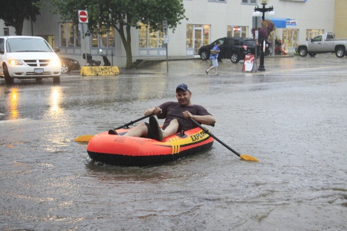
The fact that last year goes down as West Kootenay’s wettest since record-keeping began, combined with fallout including landslides and swollen creeks, rivers, and lakes that caused widespread damage and cost human lives, has earned Mother Nature the Star’s choice as 2012 Newsmaker of the Year.
The previous record year of 1998 saw 1,060 millimeters of precipitation. As of last week, we’d been deluged with 1,087 mm and counting. Rainfall was 150 per cent of normal and snow 135 per cent.
June was the wettest month ever with 227 mm, which Southeast Fire Centre weather specialist Ron Lakeman calls “quite phenomenal.”
We also had our wettest-ever March, while July, October, and November were much damper than normal but didn’t break records.
March saw nearly twice the average amount of snow — which was slow to melt — and at least a little precipitation almost every day.
But Lakeman, who has been watching local weather patterns since 1988, says the abnormal amount of rain in June and July was the real story — one torrential downpour brought 68 mm.
“March didn’t surprise me,” he says. “June and July did.”
The frequency with which new records were set is partly because they don’t go back that far, Lakeman says. They’ve only been kept at the Castlegar airport since 1966, compared to some weather stations that have been around for more than a century: “To break a record when you have that much data is much more significant.”
Nelson-specific records are even more likely to fall because the automatic weather station here has only operated since the early 1990s.
But while Lakeman says there can be variations between Castlegar and Nelson, what occurred in the especially wet months was “fairly universal” to the area.
He adds that while the cool, wet spring can largely be chalked up to La Niña, it’s much harder to explain summer and fall, and it’ll be a long time before we can say whether this year’s extreme weather was part of a bigger pattern.
“We’ve had incredibly wet periods before,” he says. “One-offs do happen. But it is unique to have so many one-offs in one year.”
Once it stopped raining, the region went through a very dry spell in August, September, and the first two weeks of October. That’s relatively common, Lakeman says, but he was surprised at how much precipitation fall brought. While it’s typical to get one storm with 20 to 30 mm of rain, we had several.
As for what early 2013 will bring, Lakeman says early forecasts suggested a minor El Niño winter, but they’ve fallen by the wayside now that we’re into a neutral cycle.
“In the neutral state anything’s possible,” he says. “All bets are off. It’s almost 50-50 how it’s going to play out.”
The latest models suggest a cooler January and February with greater amounts of precipitation — the opposite of what was predicted two months ago.
Asked if extreme and unusual weather makes his job more exciting, Lakeman answered: “It’s always interesting. No getting around that.”