by Timothy Schafer
Local Journalism Initiative Reporter, The Nelson Daily
The water quality for the residents of Six Mile will likely be affected after a portion of the Duhamel Creek watershed burned this fall, according to a recent report released by the Ministry of Forests.
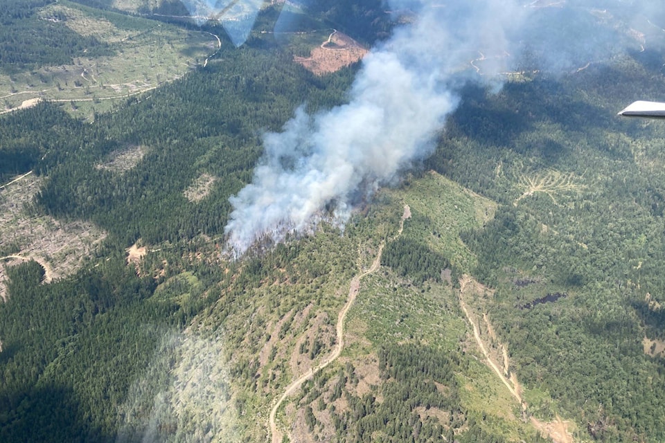
A post-wildfire and natural hazard risk analysis report for the Monument Creek wildfire that burned 660 hectares of Crown land from September into late October noted that eight per cent of the Duhamel Creek watershed (443 ha) was burned in the blaze.
As a result, there will be some changes in the water quality for the users of the creek, noted Sarah Crookshanks in her report for the Southeast Fire Centre.
“It is possible that domestic water users on Duhamel Creek will experience water quality impacts due to increased fire-related sediment load in Duhamel Creek,” she wrote. “Sedimentation is expected to be episodic, occurring during spring freshet and in response to significant rainstorms.”
That sediment will be generated by overland flow eroding and transporting sediment and ash into the creek, Crookshanks explained.
“Alternatively, it is possible that a landslide may introduce a significant volume of sediment into the creek channel,” she said.
A landslide could take two forms: a debris flow, or a failure of the Duhamel Face (Heights) Road that switchbacks up the southern end of the fire.
“This road has experienced multiple failures over the past years, one of which has reportedly introduced sediment into Duhamel Creek,” Crookshanks wrote. “Evidence of potential instability was observed at one location. The burned area may increase the likelihood of landslides originating from this road.”
She recommended full deactivation of the Duhamel Face (Heights) Road as soon as practical. “Until full deactivation is undertaken, diligent road inspection and maintenance are critical to help reduce the likelihood of additional landslides that may impact Duhamel Creek,” Crookshanks explained.
To better understand the risk, the Ministry of Forests conducts post wildfire analysis of the hazard areas that pose an increased risk to public safety, significant improvements or infrastructure.
Following a wildfire, the possibility of soil erosion, landslides and floods can increase, enhanced with intense rainfall or rapid snowmelt. In addition, wildfire can also cause snow avalanches and may affect water quality, cause erosion and result in sedimentation.
The Monument Creek fire began on Sept. 4 and burned mostly within the Duhamel Creek watershed, 17 kilometres northeast of Nelson.
The fire continued to produce smoke into late October, though limited growth was observed after mid-September.
Crookshanks said an aerial overview of the fire was completed on Sept. 26 and a site visit was undertaken on Oct. 14.