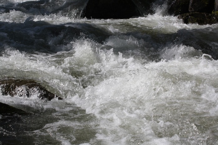
Tuesday’s heavy localized rainfall has created problems for numerous areas within the Regional District of Central Kootenay.
A state of local emergency has been declared for Area G (Rural Salmo), in addition to states of local emergency currently in place for Areas B, C (Rural Creston), H (Slocan Valley) and I (Rural Castlegar). The declaration was issued today at noon in response to land instability issues, particularly regarding an RDCK-owned tailings pond.
The facility’s retaining walls have been saturated by record rainfalls and some sloughing has occurred. Current conditions make placing equipment to do remediation work difficult. A geo-technician is on site assessing the situation and local residents have been notified.
The tailings pond was previously part of the HB mine site before being purchased by the RDCK as part of their central landfill property.
Across the region, rivers and creeks are being monitored as the rainfall has increased levels and flows. Peterman Road in West Creston (Areas B and C) remains closed due to water over the road and 32 residences on evacuation alert.
In Area D, the bridge on Keen Creek Forest Service Road is being assessed by the Ministry of Transportation and Infrastructure. The road has been closed at the bridge and four local residences were recommended to evacuate voluntarily by the RCMP. One resident has evacuated, the others are in contact with the RCMP on an ongoing basis.
Carpenter Creek near Sandon has had some undercutting of its banks and a bridge has been damaged following a debris torrent. RDCK emergency coordination staff are currently assessing the damage.
The heavy rainfall has also affected Kootenay Lake and other area reservoirs. Kootenay Lake has risen to 1753.7 feet (534.53 metres) and forecasts indicate it could rise to a record level of 1754.4 feet before peaking.
Sand and sandbags are available at locations around the lake and throughout the region. Residents are reminded to access sand and sandbags only if they are essential to protect homes and property.