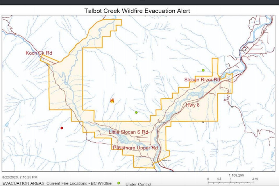
The Talbot Creek fire in the Slocan Valley has doubled in size in recent days, reaching 323 hectares.
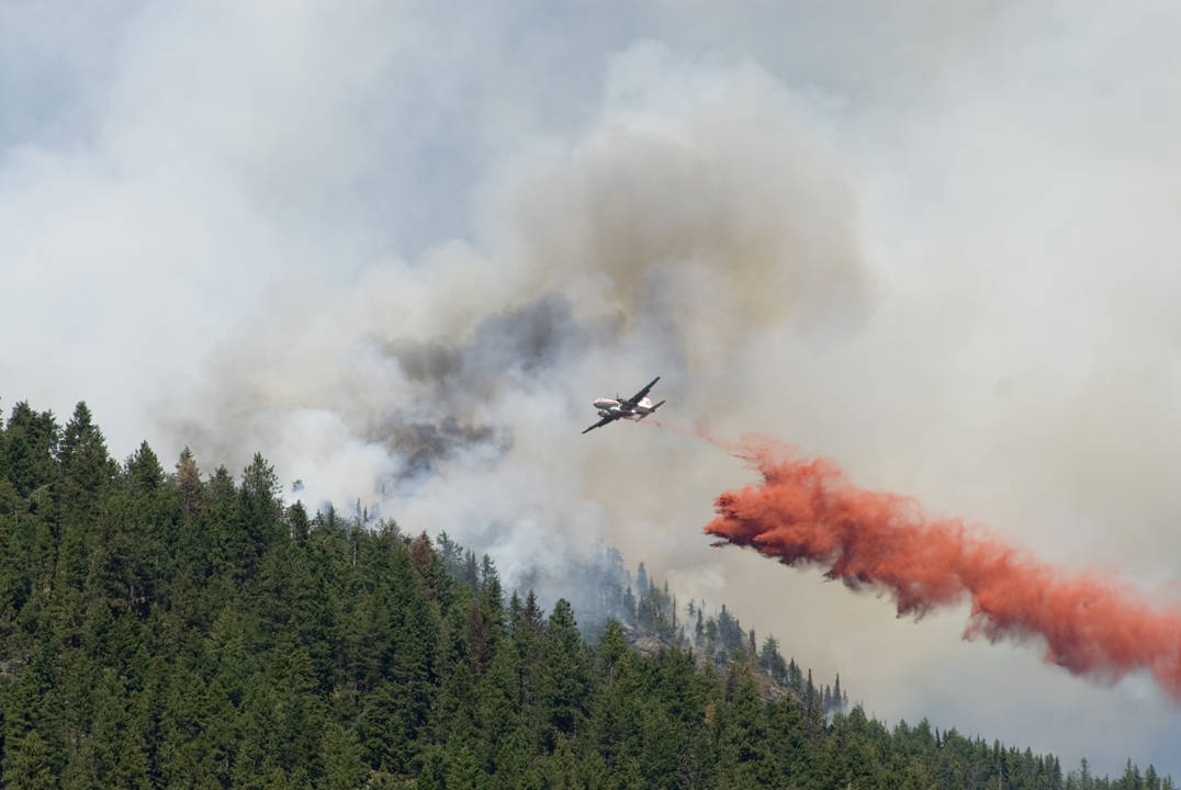
The fire growth comes in spite of concentrated efforts by the BC Wildfire Service (BCWS) to fight it both from the air and on the ground.
The lightning-caused fire was discovered Aug. 17 about 3.5 kilometres northeast of Highway 6.
BCWS says that Rank 1-2 fire behaviour was observed on Thursday. A Rank 1-2 fire generally exhibits a slow rate of spread and is a low-vigour fire that burns in the surface fuel layer on the forest floor, below the tree crowns.
This fire continues to produce smoke and is highly visible from the Slocan Valley as well as surrounding communities.
An evacuation alert remains in place for 305 homes surrounding the fire.
On Thursday, 96 firefighters, seven helicopters and 17 pieces of heavy equipment were assigned to the fire.
On Friday, 82 firefighters, nine helicopters and nine pieces of heavy equipment were assigned to the fire.
Crews are seeing continued success with developing containment lines on the northwest flank of the fire by utilizing heavy equipment in stitching together pre-existing roads, according to BCWS.
Ground crews have been working hard at creating a fuel free handline that is being tied in with the natural rocky features on the site along the southern flank.
On the lower third of the south side of the mountain, equipment is also being used to re-open existing roads to create fuel free contingency lines above the community of Vallican.
BCWS says helicopters will continue bucketing onto areas of more challenging terrain along the east flank of the fire. Due to the steep and rocky terrain on the east flank, they are employing a precision technique of applying retardant via helicopter buckets using pin-point accuracy, which allows personnel to focus suppression efforts on individual spots that are inaccessible to fire crews.
An area restriction also remains in place for the surrounding area.
An area restriction is not currently in effect for the Slocan River. But BCWS is reminding those recreating that helicopters are filling buckets in the area and to be cautious and mindful around these operations.
The largest fire burning in the West Kootenay remains the Woodbury Creek fire in Kokanee Glacier Provincial Park. It is now 480 hectares, but remains in a remote location.
One new fire was discovered Aug. 27.
The Mount Mackie fire is southwest of Castlegar. It is 0.5 hectares in size.
betsy.kline@castlegarnews.com
Like us on Facebook and follow us on Twitter