Though few changes are expected in the Nelson area, the Ministry of Forests, Lands and Natural Resource Operations is putting out for public review proposed changes to logging activity that affects viewscapes.
Changes to the visual-quality objectives in the Kootenay Lake portion of the Selkirk Resource District are proposed for consistency, says Julie Castonguay, stewardship forester at the Selkirk Resource District office. Work on the existing map was started in the mid 1980s and different people refined it on several occasions until it was last dealt with in 2002.
“It still was a good product and we’ve been working with it,” she says. “But we knew we could probably get something that was more refined and more standardized.”
Concerns that viewscapes as a resource were being overvalued in some areas while undervalued in others have been addressed by new objectives received from a contractor in early 2012.
After the Ministry evaluated recommendations and made map adjustments, they feel the end result is a much-improved visual land inventory that will endure for some time to come.
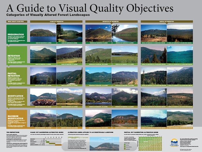
Castonguay explains visual-quality is an important consideration in timber harvest on Crown Land.
“These are the scenic areas that are visible from communities, highways and major waterways,” she says. “As you look at the surroundings, people attach a value to maintaining a certain integrity to the landscape.”
As the current version of the visual landscape inventory was reviewed, Castonguay says few changes were suggested in the areas surrounding Nelson.
“Overall, if I look at the map of the entire area, there haven’t been a whole lot of changes,” she says.
But people may have concerns about changes taking place “in their backyard,” she says and the Ministry would like to hear about these misgivings.
“It’s important that the public have access to this information,” she says. “If they have any questions or comments, they can call me.”
Every comment will be addressed, assures Castonguay. After public input, it’s hoped that the proposal will become a legally recognized visual land inventory prior to the end of 2013.
Details and a map are available for viewing at the Selkirk Resource District office at 1907 Ridgewood Road on the North Shore. The map is also available online at http://www.for.gov.bc.ca/ftp/DCO/external/!publish/DKL_VLI/
Comments should be submitted to the district office attention Castonguay via email, julie.castonguay@gov.bc.ca, phone 250-825-1147, fax 250-825-9657 and regular mail to the above address by August 15.