Ever heard of the Macbeth Icefield?
Nothing tragic or vengeful comes to mind like the Shakespeare play when looking at the photos of this magnificent West Kootenay landscape.
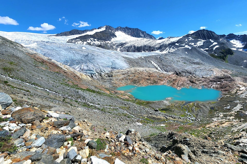
Instead, the first word that may come to mind looking at the Macbeth Icefield is “glorious.”
Brenda Haley, an experienced hiker from the Trail area, shares photos from the wondrous places on Earth that she explores, which of course, are located right here in the West Kootenay.
She made this hike to this icefield, located near Kaslo, on Saturday.
Though it wasn’t her first time.
“But it was the first time I could explore the edge of the icefield because it used to cover half the lake,” Haley told the Trail Times.
“It (the ice) has receded past the end of the lake so we could walk along the edge of the glacier. That was super cool!”
About Macbeth Icefield (Kaslo)
Macbeth Icefield is one of the premier hikes in the Kootenays.
From the 4WD-accessible trailhead the trail is 12 kilometres (km) round trip, and 15.6 km round trip from the spur at Glacier Creek Forest Service Road (FSR).
This challenging trail has a nine to 10 hours hiking time round trip, and is accessible from July to October.
The lower 2 km trail follows the creek and provides views of scenic meadows.
From the meadow the trail climbs steeply to an alpine lake near the edge of the icefield.
The primary activities are hiking, camping, mountaineering and viewing.
Driving directions from Kaslo: Driving time is roughly 1.5 hrs, and a two-wheel high clearance vehicle is required.
From Kaslo head North on Hwy 31N towards Lardeau/Duncan Lake. Turn right on Argenta Rd (35 km from Kaslo), and set your odometer to 0. Cross a bridge and reach a junction at 2.3 km, proceed straight. At 12 km turn right (North-East) and ascend onto Duncan-Glacier Creek FSR. At 22.5km reach a fork and turn left (east).
From here its a a 1.8 km mandatory 4x4 to the trailhead which is slightly overgrown and may scratch your vehicle, otherwise park on the Glacier Creek FSR.
Strong hikers can reach the trailhead on foot from the spur at 22.5 km in 20 minutes.
-with provincial files from sitesandtrailsbc.ca
Read more: The Kootenay’s great Mount Gladstone
Read more: Got snow? Summertime in the Kootenays sure does
newsroom@trailtimes.ca
Like us on Facebook and follow us on Twitter